WEATHER ALERT
ENVIRONMENT CANADA
**************************
Winter storm warning continued for:
- Newmarket - Georgina - Northern York Region
- Barrie - Orillia - Midland
- Owen Sound - Blue Mountains - Northern Grey County
- Listowel - Milverton - Northern Perth County
- Waterloo - Wellington
- Innisfil - New Tecumseth - Angus
Current details:
Winter storm expected this evening to Saturday morning.
Hazards:
Heavy snowfall with total accumulations of 10 to 25 cm.
Peak snowfall rates of 3 to 5 cm per hour.
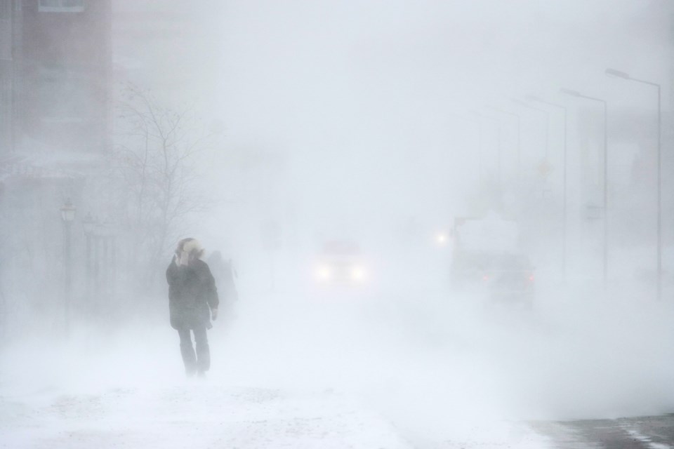
Strong wind gusts resulting in significantly reduced visibility in blowing snow.
Timing:
This evening to Saturday morning.
Discussion:
Snow is forecast to begin late this afternoon and will quickly become heavy at times, before transitioning to periods of rain tonight as temperatures rise above freezing. Strong southeasterly winds gusting up to 70 km/h will combine with this heavy snow to cause significantly reduced visibility at times.
In the wake of this system, much colder Arctic air will become established across the region. A multi-day lake effect snow event is expected for locations east of the Great Lakes bringing additional snowfall accumulations to some communities.
Surfaces such as highways, roads, walkways and parking lots may become difficult to navigate due to accumulating snow. Visibility will be suddenly reduced to near zero at times in heavy snow and blowing snow.
Consider postponing non-essential travel until conditions improve.
Please continue to monitor alerts and forecasts issued by Environment Canada. To report severe weather, send an email to [email protected] or tweet reports using #ONStorm.
**************************


